
From the ground, Dubai’s Palm Jumeirah is an impressive luxury destination lined with hotels, villas and beaches. But from hundreds of kilometres above Earth, it reveals its true scale. The palm tree-shaped artificial island, built entirely through land reclamation, is one of the few human-made structures that is instantly recognisable in satellite images and photographs taken from the International Space Station. More than two decades after construction began, Palm Jumeirah continues to fascinate scientists, astronauts and engineers alike. Modern satellites from the European Space Agency (ESA) regularly capture the island alongside Dubai’s ever-expanding coastline, highlighting how human engineering has permanently reshaped part of the Persian Gulf.
Why Dubai’s Palm Jumeirah remains one of the world’s most recognisable engineering marvels from orbit
The Palm Jumeirah was conceived in the early 2000s as an ambitious land reclamation project to expand Dubai’s coastline. Instead of a conventional island, engineers designed it to resemble a date palm, a tree deeply rooted in Middle Eastern culture.The island consists of a central trunk connected to 17 palm fronds, all surrounded by an 11-kilometre crescent-shaped breakwater that protects it from waves and coastal erosion. This distinctive geometry makes the island stand out clearly in satellite imagery.According to the European Space Agency (ESA), the relatively shallow waters of the Persian Gulf and the broad continental shelf made the enormous construction project possible. Around 100 million cubic metres of rock and sand were used to create the Palm Islands, adding approximately 120 kilometres of new coastline to Dubai.
Do you think artificial islands, like Palm Jumeirah, are beneficial for coastal cities?
3k+ users shared opinion today
5k+ users already voted today
3k+ users shared opinion today
A landmark repeatedly photographed by satellites
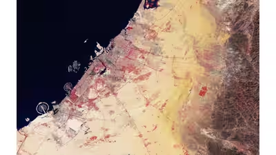
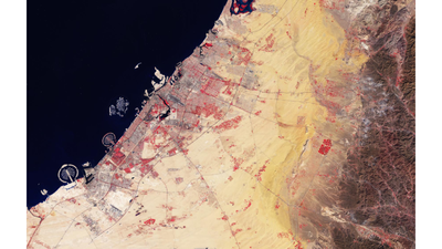
Palm Jumeirah has become a favourite subject for Earth-observing satellites. Early ESA images from the Envisat mission in 2005 and Proba-1 in 2007 documented the rapid development of Palm Jumeirah alongsideThe World Islands, another ambitious artificial archipelago off Dubai’s coast. These images provided one of the first clear orbital views of the city’s dramatic coastal transformation.Nearly two decades later, ESA’s Copernicus Sentinel-2 satellites continue to monitor the area in much greater detail. A 2024 false-colour image captured Dubai at a resolution of 10 metres, clearly showing Palm Jumeirah, Palm Jebel Ali and The World Islands. In the same image, vegetation appears bright red due to infrared imaging, while the surrounding Gulf displays varying shades of blue depending on water depth.ESA also noted that Dubai has expanded dramatically over the decades, growing from roughly 54 square kilometres in 1975 to nearly 977 square kilometres by 2015, with the artificial islands playing a major role in that expansion.
Palm Jumeirah: More than a luxury destination
Although Palm Jumeirah is famous for luxury resorts, including Atlantis The Palm, it also represents one of the world’s largest land reclamation projects.Astronauts aboard the International Space Station have repeatedly photographed the island because its palm-shaped outline remains easily distinguishable from orbit. Palm Islands and The World Islands are among Dubai’s most recognisable human-made landscapes visible from space, with Palm Jumeirah alone requiring more than 50 million cubic metres of dredged sand during construction.Today, Palm Jumeirah is home to thousands of residents, hotels, restaurants and entertainment venues, while continuing to serve as a striking example of how satellite technology can document human transformation of Earth’s surface over time.As Earth-observation satellites become increasingly sophisticated, Palm Jumeirah remains one of the clearest examples of how modern engineering can create structures large enough to be recognised from space, turning an ambitious coastal development into one of the planet’s most iconic orbital landmarks.